La Calera


Guavio, Cundinamarca, Colombia
Suggest Place to Visit
757
Track to location with GPS |
 |
The name of this town comes from the limestone mine, or limestone as it was said in the past. The indigenous town was called Teusacá, which, according to some historians, means ´´prison´´ and according to Acosta Ortegón it is ´´ended fencing´´. By the year 1597 the natives were not based in Teusacá nor did they have a church, during the visit made by the Oidor Ibarra. By order dated September 1, 1604, the Oidor Lorencio de Terrones ordered the gathering of the Indians of Teusacá, with a total of 359 distributed in the districts of Teusacá, Suabso, Tabtiba, Suto and Tuchasgula.
It was his doctrinal priest Fray Nicolás de Troya, who declared that the existing church was made of straw, but that the bricklayer Alonso Hernández was making another. On October 7, 1639, the oidor Gabriel de Carvajal came to Usaquén and by order of the 14th he decided to add those from Teusacá to Usaquén. In the year 1765, Don Pedro de Tovar y Buendía appears as the owner of the La Calera farm, around whose house the hamlet was formed with relatives and the parish of whites was founded under the patronage of Nuestra Señora del Rosario, whose image was already venerated in 1772, the year in which the town is supposedly founded on December 16, under the patronage of the owner of the hacienda. Of which there is no testimony or authorization.
Rather, it seems that it is the date when the existing chapel was erected in a parish. By decree No. 73 of March 14, 1850 of the Government of the Province of Bogotá, the district was abolished and its territory was added to the capital. By ordinance No. 154 of October 21, 1851, the parochial district of La Calera was restored from the 1st. January 1852. By ordinance No. 197 of December 14, 1853, the suppressed district of La Calera was erected in a village. Thus, the town of La Calera is not of indigenous origin but white and owes its name to the hacienda, which was given to it because of the limestone mines of the region and because the place where it is extracted is often called lime.
Here in La Calera Don Pedro appeared and a few years later he married Doña Antonia María de Ricaurte, daughter of Don José, who already owned the Hacienda de Teusacá La Calera in 1704. He was the one who built the manor house, whose chapel from those times was dedicated to Our Lady La Virgen del Rosario. Here too many of the founder's descendant family members rest on this soil. This house and its chapel along with some other constructions, actually formed the house of the hacienda and its dependencies; Over time, it became the town of La Calera.
The mist of time has covered with its cloak the events of the foundation, the future of the colonial characters of independence and the families close to the descendants of Don Pedro Tovar y Buendía. The walls, silent witnesses of the house and the chapel, are a material testimony of the life that developed on the site for several generations and are linked to what formed the national heritage.
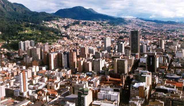
La Calera is a municipality of Cundinamarca. Guavio Province The municipality is located northeast of Bogotá, near the town of Chapinero.
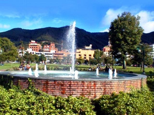
Due to its proximity to Bogotá (9 km), La Calera has established itself as an important tourist attraction, especially for its viewpoint and as a dormitory city for high-income families. It is part of the Bogotá Metropolitan Area, according to the 2005 DANE census.
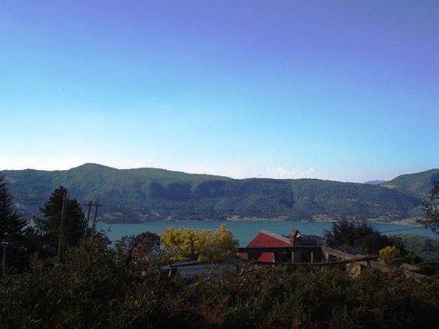
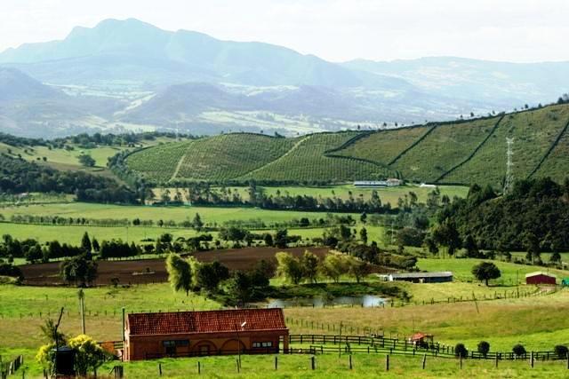
La Calera is located on the Andean region of Colombia, it is located between 2500 and 3000 meters above sea level, so it has cold thermal floors and paramo. Its economy is varied since it includes the traditional agriculture of potatoes, corn, cubes, carrots, etc. cattle raising, horses, sheep, goats, trout fish farming, etc. On the other hand there is an important mining of limestone and sand pits etc. And an industry that includes the production of Samper cement from the multinational Cemex, the Agua Manantial from The Coca Cola Company, also within the jurisdiction of La Calera are the two large dams that supply the Aqueduct of Bogotá San Rafael and Chingaza. Tourism is also important because you can access the Chingaza National Park, the viewpoint over Bogotá, the nightclub area, and many recreational farms are in La Calera. The population is mostly mestizo.
Physical description:
La Calera is located east of the department of Cundinamarca and northeast of Bogotá. Its head is located at 4 ° 43´ 17´´ north latitude and 73 ° 58´ west longitude of Greenwich; with respect to the city of Bogotá (capital of Colombia) in arc 0 ° 06´ 29´´ east.
Limits of the municipality:
The Municipality of La Calera limits:
• To the north with the Municipalities of Guasca, Sopó and Chía.
• To the east with the Municipality of Guasca.
• To the west with Bogotá.
• To the south, with the municipality of Choachí and Bogotá.
Total extension: It is approximately 485 square kilometers. According to data provided by DANE Km2
Urban area extension:
Rural area extension: the total area of the Municipality is 17,913.0 hectares Km2
Altitude of the municipal seat (meters above sea level): 2718 Mts above sea level
Average temperature: 14 degrees centigrade
Ecology
OROGRAPHY: The Municipality of La Calera is characterized by its location within the beautiful valley on the Teusacá River. Its entire territory from south to north is crossed by the eastern mountain range that presents numerous branches, including the green cross that covers it on the eastern and western sides, giving a rather broken appearance, alternating valleys, hills and elevations, originating a contrast wonderful, making its topography much admired by tourists.
HYDROGRAPHY: The hydrography of La Calera belongs to the Magdalena and Meta slopes. Two rivers cross the municipality El Teusacá and El Río Blanco. Teusacá River: It is born in the Laguna del Verjón located on the Monserrate hill and flows into the Funza or Bogotá river. Numerous streams increase their flow, the most important being that of Hato, Marmaja, Cara de perro, Carrizal, Chocolatero, Cirujano, San Isidro, Siecha, Simayá and Aguas Claras. Río Blanco: It is born in the Buitrago lagoon on the border with the Municipality of Guasca, receiving in its path quite abundant ravines such as: La Marmaja, La Ramada, Colostros, Jaboncillo that is formed by the union of the Chocolatero and Palacio streams, in addition of the Blanca stream that it receives in the limits with Choachí. The Blanco River gives its waters to the Negro River at the site of the Union. In the Jaboncillo stream there is a fall, which could be used to provide electricity to the Veredas de Mundo Nuevo and La Polonia.
Over the Palacio ravine there is a small natural bridge about 8 meters long and 3 meters wide. The water broke a huge rock whose depths are inhabited by nocturnal birds that the inhabitants of the region call ´´Guacos´´; from these animals the natives obtained a fat that they used as medicine. There is only knowledge of the existence of these animals on the Iconzco bridge in Tolima and on this bridge, which is not referenced in geography texts from Cundinamarca. Lagoons: Among the most important are those of Buitrago, La Brava and that of Los Patos.
GEOLOGY: The formation of useful materials from the soil and subsoil of the Sabana de Bogotá and its surroundings belongs to the formations of ... Guaduas (Kg.). It is divided into three sets of which the upper one is made up of reddish, bluish, greenish and purple clay, among which there are unexploitable mantles of coal and banks of non-stable sandstones, of more or less coarse grain.
In the southwest of La calera there are usually coal beds towards the base of the upper set, which are exploitable. The middle or productive part contains the coal mantles and is distinguished by the presence of sandstones, of which the upper part is called ´´lajosa´´ and the lower part ´´the guide´´. The intermediate, dark gray clays are compact or striped and often carbonaceous.
Economy
The Municipality of La Calera based its economy for many years on mining, with the cement company SAMPER, this company generated direct and indirect employment for about three thousand people in the Municipality. During all the time that SAMPER cement remained operating at full speed, neither the population nor the entities in charge of the planning of the Municipality foresaw the possibility that it would terminate its activities, hence at the time that SAMPER closes its plants, the Municipality is not prepared to face this unemployment that is generated, so serious was the problem that at this time the economy has not yet been reactivated, helped in large part by the lack of serious policies in terms of job creation by the territorial entity.
Currently, the largest companies operating in the Municipality are Manantial, Winter, Tecnoconcreto, Cemex, La Pradera pasteurizer, Flores El Cortijo and a series of small domestic Micro-companies.
Communication channels
Aerial:
None
Terrestrial:
The road infrastructure of a Municipality represents an important sector that motivates and facilitates the development of a territory, being the fundamental basis of communications, access from the countryside to the urban area with products, and the exchange of goods and services between different communities
River:
None
Transport
There are three roads that connect Bogotá with the municipality of La Calera, the Bogotá Sopó road (Avenida Circunvalar at the height of 85th street south-north direction), La Autopista Central del Norte (Autopista Norte taking the detour to Briceño, and then towards the south by the Bogotá Sopó road, and the third option is by an uncovered road that crosses the eastern hills located in the El Codito neighborhood of Bogotá on the Seventh Race (Seventh Race at the height of 185th Street), this road ends on the Bogotá Sopó road to the north of the municipality.
Places of interest
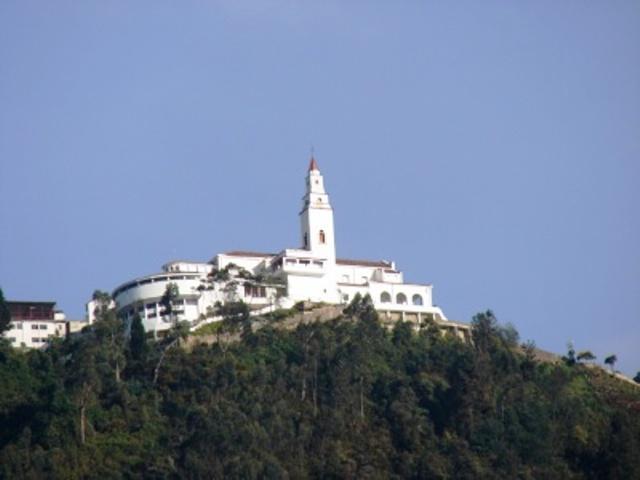
La Calera viewpoint
La Calera Hot Springs
Handicrafts: woven in virgin wool, acrylic, and wicker and wooden furniture
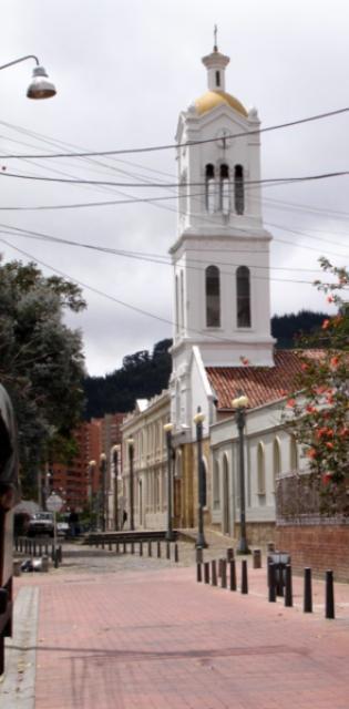
Colonial Chapel
Chapel of the Government House: houses works by the master Gregorio Vázquez de Arce y Ceballos
Cerro near Piedra
Cerro La Aurora
Cerro La Hondura
Cerro La Pita
Cerro San Vicente
Salt mountain range
Typical food restaurants (Parrillada), restaurants such as El Tambor, La Mazorca, Casa Piedra, Smoke and Flavor, among others.
Comments
We don´t have yet any comments about:
La Calera
La Calera
Be the first to leave a comment as it is very important to inform other people
Outros locais a visitar
Within a radius of 20 km from:La Calera
Usaquen |
| 6,6 Km |
 |
Park 93 |
| 9,9 Km |
 |
Montserrat Sanctuary |
| 15,9 Km |
 |
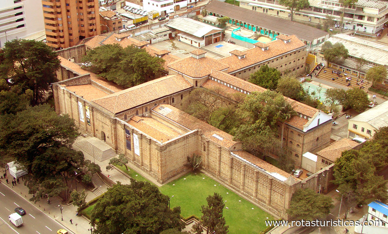
National Museum of Colombia |
| 15,9 Km |
 |
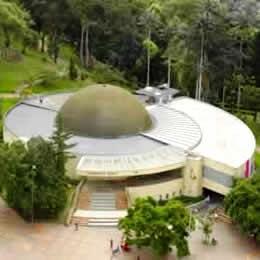
Planetario de Bogotá |
| 16,3 Km |
 |
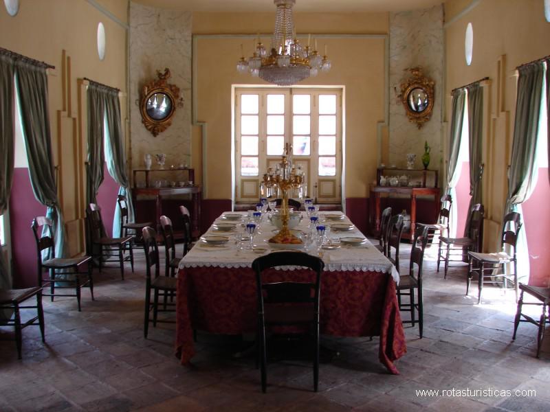
House museum Simon Bolivar |
| 16,6 Km |
 |
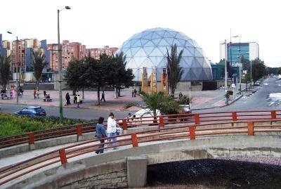
Parque Maloka |
| 17,0 Km |
 |
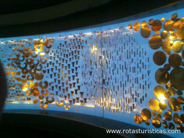
Museo del Oro |
| 17,3 Km |
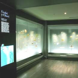 |
Gold Museum |
| 17,3 Km |
 |
Museo de Bogotá |
| 18,0 Km |
 |
Guasca |
| 19,0 Km |
 |
Bogotá Distrito Capital (d.c.) |
| 19,1 Km |
 |
Hotel reservation near La Calera within a radius of 20 km

Why to book with CLUBE TRAVEL
The best prices
Our partnerships with the world´s largest operators offer research on the best market prices.
More options
At Rotas Turisticos you can book the hotel, buy the air ticket, book the transfer from the airport to the hotel and vice versa, book the local excursions, rent the car, take travel insurance and consult the places to visit and where to go.
Holiday Tips & Destinations
Hundreds of holiday destinations with all the options that allow you to easily choose the destination that best suits your dream vacation.
CLUBE TRAVEL
Links
Follow us on social networks


